
Hour 0

Hour 1

Hour 2

Hour 3

Hour 4
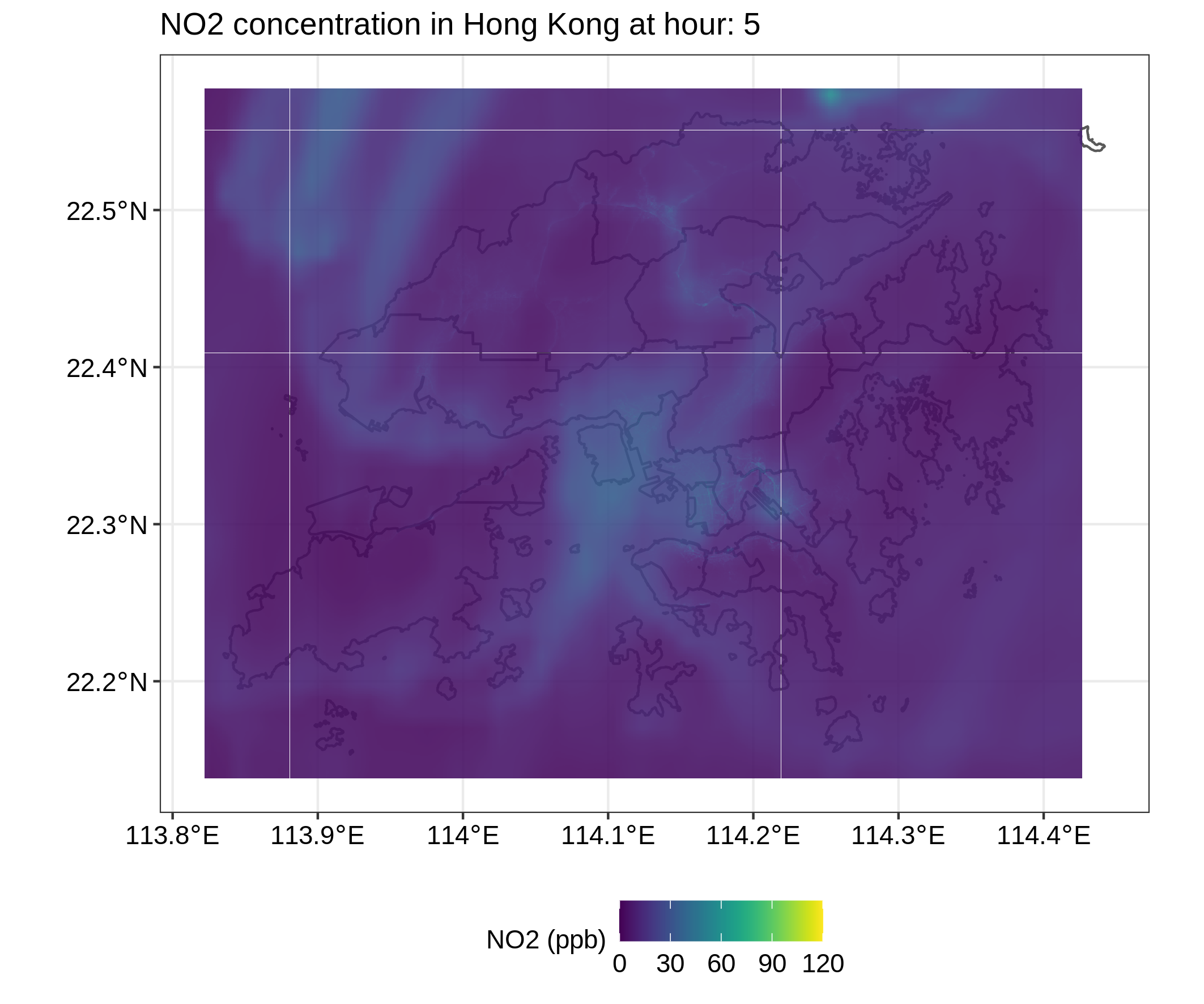
Hour 5

Hour 6

Hour 7
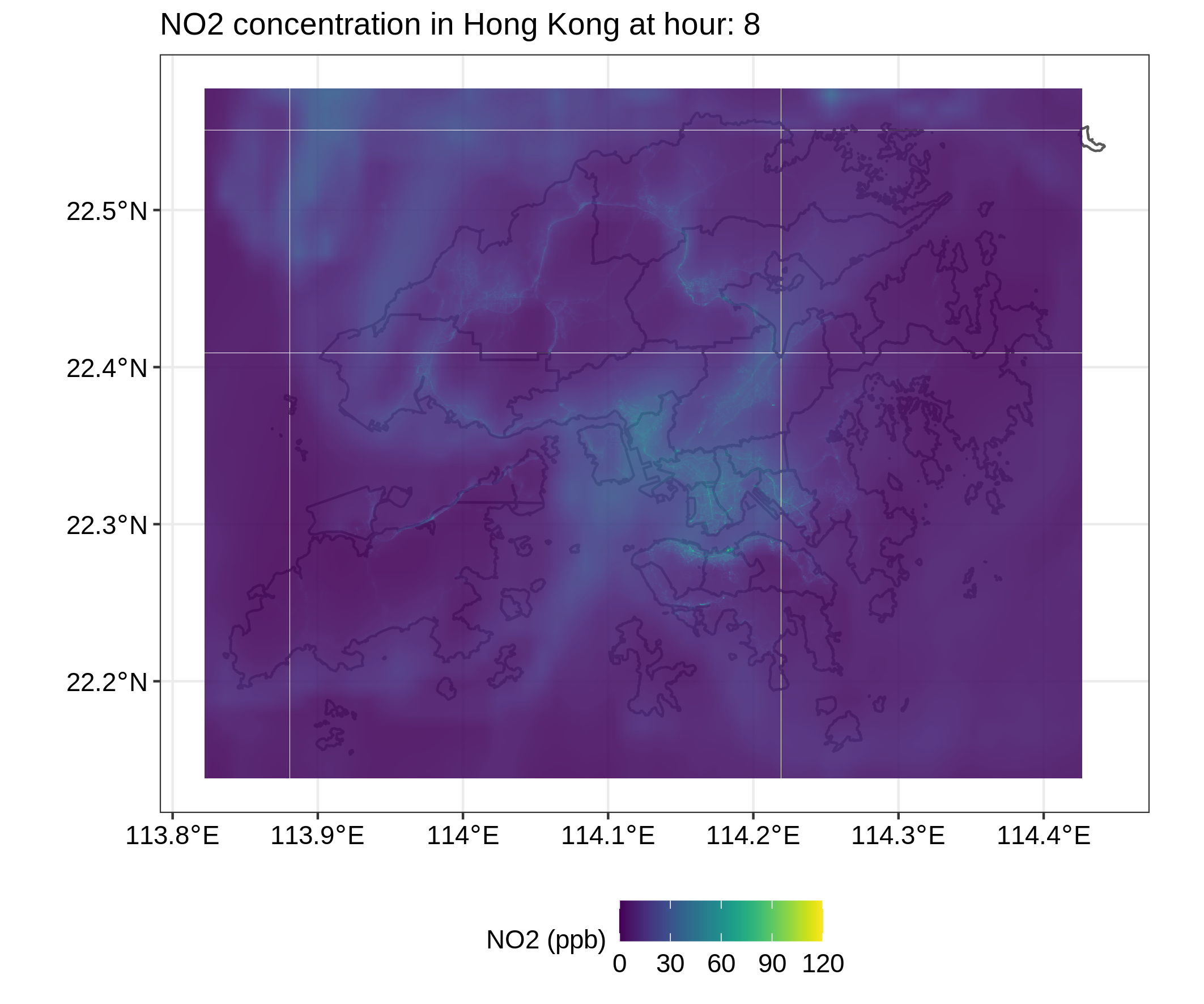
Hour 8
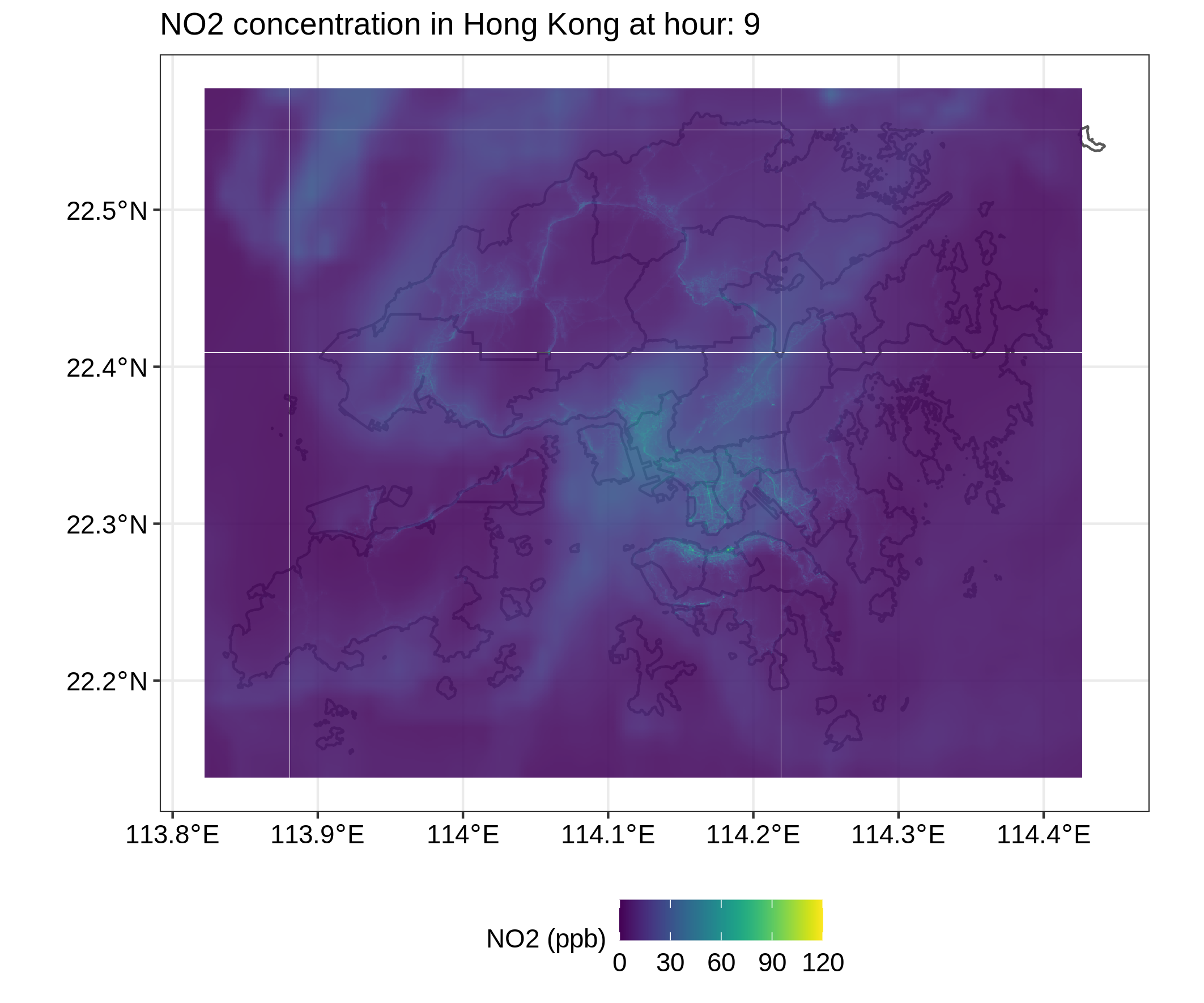
Hour 9
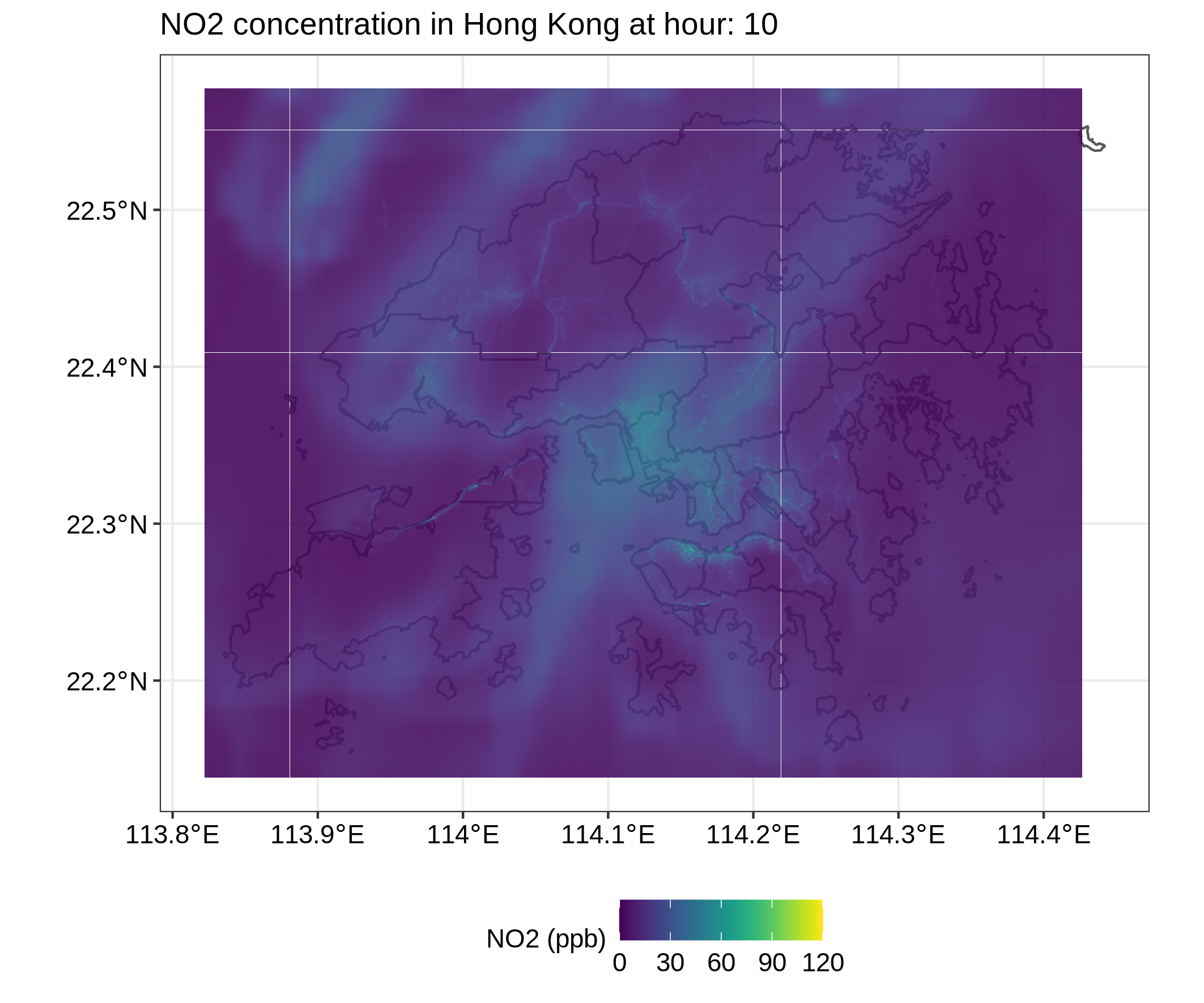
Hour 10
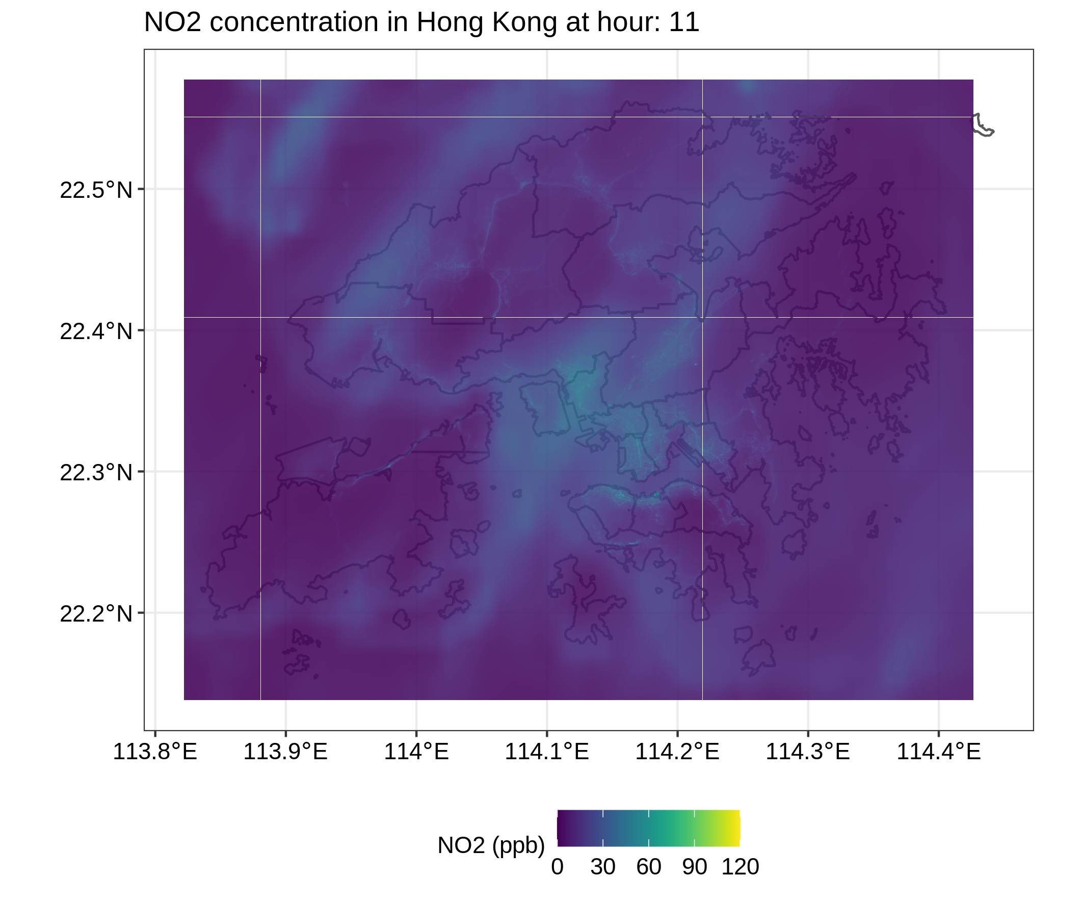
Hour 11

Hour 12

Hour 13

Hour 14

Hour 15

Hour 16
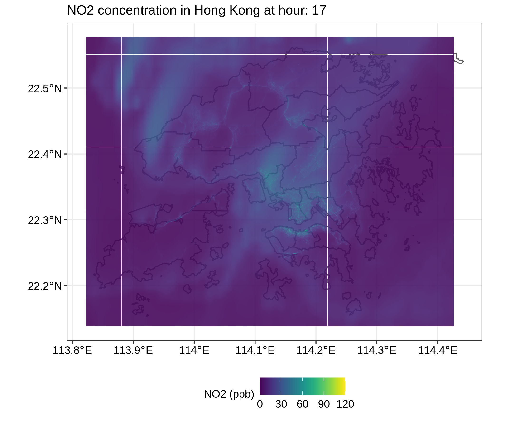
Hour 17

Hour 18

Hour 19

Hour 20

Hour 21
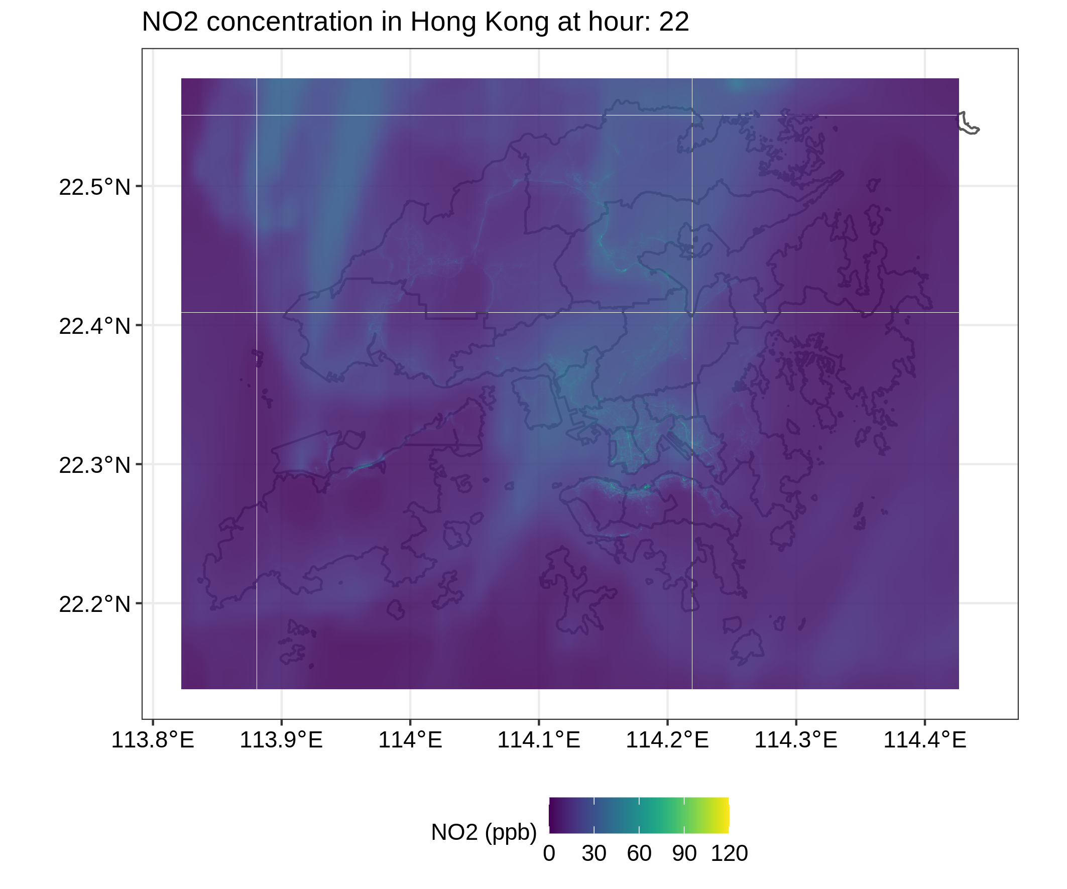
Hour 22

Hour 23
High temporal-spatial pollution data in city of Hong Kong |
|---|
Format: Raster dataset of 30 randomly sampled days in 2019 for NO2, O3, PM2.5 and PM10 in hourly resolution with grid cells of 45m * 48m over the Hong Kong domain (1000 x 1000 pixels). Units are in μg/m3 for PM10 and PM2.5 and ppb for NO2 and O3.
Size: The dataset contains 720 raster files (30 days * 24 hours) for each pollutant, which in total sums up to 2880 files. The below maps show an example of 24-hour evolution of NO2 concentrations over the study domain, generated from 24 raster files.
|
Hour 0 |
Hour 1 |
Hour 2 |
Hour 3 |
|
Hour 4 |
Hour 5 |
Hour 6 |
Hour 7 |
|
Hour 8 |
Hour 9 |
Hour 10 |
Hour 11 |
|
Hour 12 |
Hour 13 |
Hour 14 |
Hour 15 |
|
Hour 16 |
Hour 17 |
Hour 18 |
Hour 19 |
|
Hour 20 |
Hour 21 |
Hour 22 |
Hour 23 |
Acknowledgement:
The development of the high temporal-spatial pollution data was supported by the PRAISE-HK project (http://praise.ust.hk/).
Reference:
Hohenberger, T. L., Che, W.W., Fung, J. C.H., & Lau, A. K.H. (2021). A proposed population-health based metric for evaluating representativeness of air quality monitoring in cities: Using Hong Kong as a demonstration. Plos one, 16(5), e0252290. https://journals.plos.org/plosone/article?id=10.1371/journal.pone.0252290
This site is published by the Institute for the Environment (IENV), the Hong Kong University of Science and Technology (HKUST). The information on this site shall be used for education and research purpose only. Commercial or publication use of these information must obtain approval from the original information provider and/or HKUST. IENV and HKUST (and all its staff) make no warranty or representation with respect to the accuracy, completeness or usefulness of the information contained herein, and shall not have any legal liability (including liability for negligence) for any loss, damage, or injury which may result from the supply or use of such information.
Environmental Central Facility • Institute for the Environment
© Copyright 2025